Flaucher & Isarauen
Flaucher & Isarauen
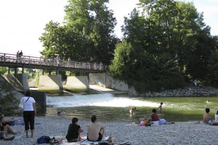
In the south of Munich in the borough Sendling close to the zoo “Hellabrunn” the area around the river Isar is called “Flaucher”. Centuries of flooding have created a very natural meadow landscape.
The name of this part of the river Isar goes back to a restaurant “Zum Flaucher” that was built around 1870 in a forester’s lodge from about 1800 in the western meadows of the river Isar.
At the beginning of the 20th century this areas was caught up by the industrialization when the power stations Isar I to III were built. Water from the river Isar was then derived into a canal.
Since the year 2000 the stream landscape of the river Isar in Munich has be recultivated. Also the landscape of the Flaucher was put into its old shape with a lot of effort. This had a positive effect on nature and made space for a big recreation area close to the city.
Today “Flaucher” is very popular among Munich locals and tourists. Especially on warm summer evenings and weekends there are many people on the gravel beaches, having a barbecue and party.
You can display Google's 3D map by clicking on the image below. A connection to the Google servers is only established with this click. Please read our information on Privacy Policy.
Flaucher & Isarauen at a glance!
Photos
Flaucher & Isarauen - Map
Listen to Informations of Flaucher & Isarauen as audio
QR-Code Mobile-Version
Address and Links
Further Information
* Photo: By Schlaier (Own work) [Public domain], via Wikimedia Commons
* Background image: By Schlaier (Own work) [Public domain], via Wikimedia Commons


