You can replace the displayed maps from Google with an interactive map by clicking on the map image. A connection to the Google servers is only established with this click. Please read our information on Privacy Policy.
Aubinger Lohe

Aubinger Lohe

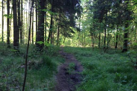
Aubinger Lohe (also known as “Aubinger Loche“, but seldomly used) is a woodland on a hill in the western parts of Munich. Since its forestation with spruces it is no longer a woodland as defined by the German word „Lohe“.

Aubinger Lohe is situated completely in the territory of the city of Munich. In the north it borders on the district Lochhausen, in the south east on the district Aubing and it is surrounded by fields and meadows. In the south Aubinger Lohe is devided by a road and the railway line Munich – Fürstenfeldbruck which is also the border to the „Aubinger Moos“.

You can display Google's 3D map by clicking on the image below. A connection to the Google servers is only established with this click. Please read our information on Privacy Policy.

Aubinger Lohe at a glance!

Photos

Trailrunners Paradise

Trailrunners Paradise

A real treasure west of Munich Beautiful trails There a two tiny lakes This one is the more beautiful one :o) A great opening View from the hill Plenty places two take a rest Trailrunners Paradise A beautiful mixed forest The lake in the morning

Toolbar-Menu

Aubinger Lohe - Map

Picture: Map of location: Aubinger Lohe

Listen to Informations of Aubinger Lohe as audio

QR-Code Mobile-Version

Address and Links

Aubinger Lohe
Bushaltestelle Asmarsstraße
S-Bahn Lochhausen

This Website is currently under maintainance, information could be outdated.

Holidays from the 1st click!